
Montville ZIP Code Coverage
Montville is organized around the principal sections of Montville, Towaco, and Pine Brook, plus the named Lake Valhalla community. The official municipal analysis identifies three principal postal areas and a smaller group served through neighboring Kinnelon and Boonton postal places. Use the postal area to verify delivery formatting, then keep it distinct from the address’s township and parcel identity.
| ZIP | Areas Covered | Post Office | Notes |
|---|---|---|---|
| 07045 | Montville section and principal Montville postal area | Montville postal routing | Official analysis: 10,655 people, 50.6% |
| 07082 | Towaco | Towaco postal routing | Official analysis: 5,192 people, 24.7% |
| 07058 | Pine Brook | Pine Brook postal routing | Official analysis: 5,068 people, 27.2% |
| Kinnelon/Boonton use | Montville addresses served through neighboring postal places | Neighboring routing | 143 people reported; the source does not publish the ZIP digits |
The three listed numeric areas account for 20,915 people in the municipal report. The additional 143 residents were counted in Kinnelon or Boonton postal areas, but the official PDF did not state the digits. Do not fill in those digits from guesswork. Confirm any neighboring address with USPS before recording its postal code.
Montville Postal Population Context
Those figures belong to the township’s 2019 ZIP analysis, which reports a total population of 21,058. They should not be presented as a current census total. Census QuickFacts reports Montville’s 2020 population as 22,450 and its 2025 estimate as 24,469. The three measures have different dates and geographic methods, so they are not interchangeable.
Record the source year with every count. The difference is also a useful warning: a municipality can contain residents whose postal routes use an adjacent place, while a familiar postal label can extend beyond the municipal line. Postal geography describes mail routing. It does not create a population boundary or establish where a property lies.
Use the figures as a snapshot of the report’s service-area analysis, not a percentage of every current mailing address. The Kinnelon and Boonton exception is precisely why an address list must retain both its municipality and its USPS result. A number that looks precise can still describe a different geography from the tax district or Census boundary being compared.
Note: Keep the report’s percentage and year together when quoting any of its postal-area counts.
Verify a Montville ZIP Code
USPS ZIP Code Lookup is the delivery-verification tool for a complete address. It can standardize an address, but it does not verify that a particular person or organization is located there. Use an apartment or unit when needed, and test both a township label and the relevant postal place if the first result does not match the address record.
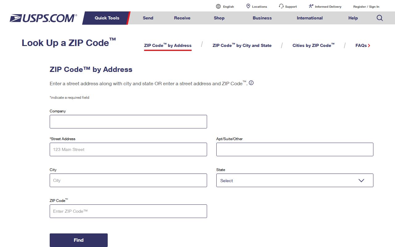
The USPS screen offers three separate lookups. Choose the one that matches the information in hand instead of treating the city field as proof of a municipal boundary.
| By Address | Company is optional; enter street, city, state, and ZIP if known. |
|---|---|
| By City and State | Enter a city and state to retrieve applicable postal-area results. |
| By ZIP | Enter the numeric postal code to retrieve USPS routing information. |
| Best verification detail | Use a complete street address and unit number where applicable. |
Montville Postal Search Limits
There is no verified ZIP-wide public resident export for Montville. The Morris County Tax Board search is organized by property location, owner, block and lot, or prior block and lot. The Morris GIS Parcel Searcher is parcel and address based. New Jersey’s registration checker is person and registration based, not a street or ZIP roster. A postal code alone is therefore not the right starting field for each of those systems.
- Use USPS to confirm the delivery form of a complete address.
- Search the Tax Board by municipality or district, house number, and street, then retain the block and lot.
- Use the GIS Parcel Searcher by municipality, owner, street address, or parcel ID to locate the mapped parcel.
- Use the state voter checker only to verify a person’s own registration status with the required personal matching information.
- For a disputed civic address, ask the Township Clerk or Construction/Zoning office for the relevant official record and include the block and lot.
This sequence narrows an address without promising a ZIP search that the inspected local portals do not offer. For a block-by-block address workflow, use the Montville by street directory after the delivery address is confirmed.
Postal Areas Versus Montville Limits
A postal code identifies USPS routing. It does not prove municipal incorporation, legal parcel location, or tax district. A situs address is the physical property location. A tax mailing address is where notices are sent. The legal parcel description appears in deeds and recorded maps. These labels may align, but they answer different questions.
- ZIP code and ZIP+4
- The five-digit code identifies a postal area. The added four digits refine delivery routing within that area.
- PO Box ZIP
- A code assigned to post-office boxes. It does not identify a street location.
- Unique ZIP
- A code assigned to one large organization or delivery destination. None was verified for Montville in the reviewed material.
- Carrier route
- A delivery sequence used by USPS inside a postal area. It is not a town boundary or parcel description.
Montville Postal Place Names
Postal labels can preserve older local language. Towaco has appeared as Hook Mountain, Glenview, and White Hall. Pine Brook has a separate village identity and old post-office references. Lake Valhalla is another local community name. Historical directories, deeds, church records, maps, and newspaper notices may use one of these names rather than the current postal form.
Route 202 follows an old transportation route, and the Morris Canal was completed in 1828. Those road and village patterns help explain why an old address may be identified by a cross street, road, or place name instead of a modern postal code. Preserve both the historical label and the current USPS-normalized form when they differ.
Montville Postal Parcel Checks
Morris County GIS applications help locate a parcel and compare map layers after the address has been verified. The public parcel tool supports quick searches by municipality, owner name, street address, or parcel ID, as well as map browsing, filters, and a buffer-in-feet control. It is for locating and inventorying, not a survey or legal description.
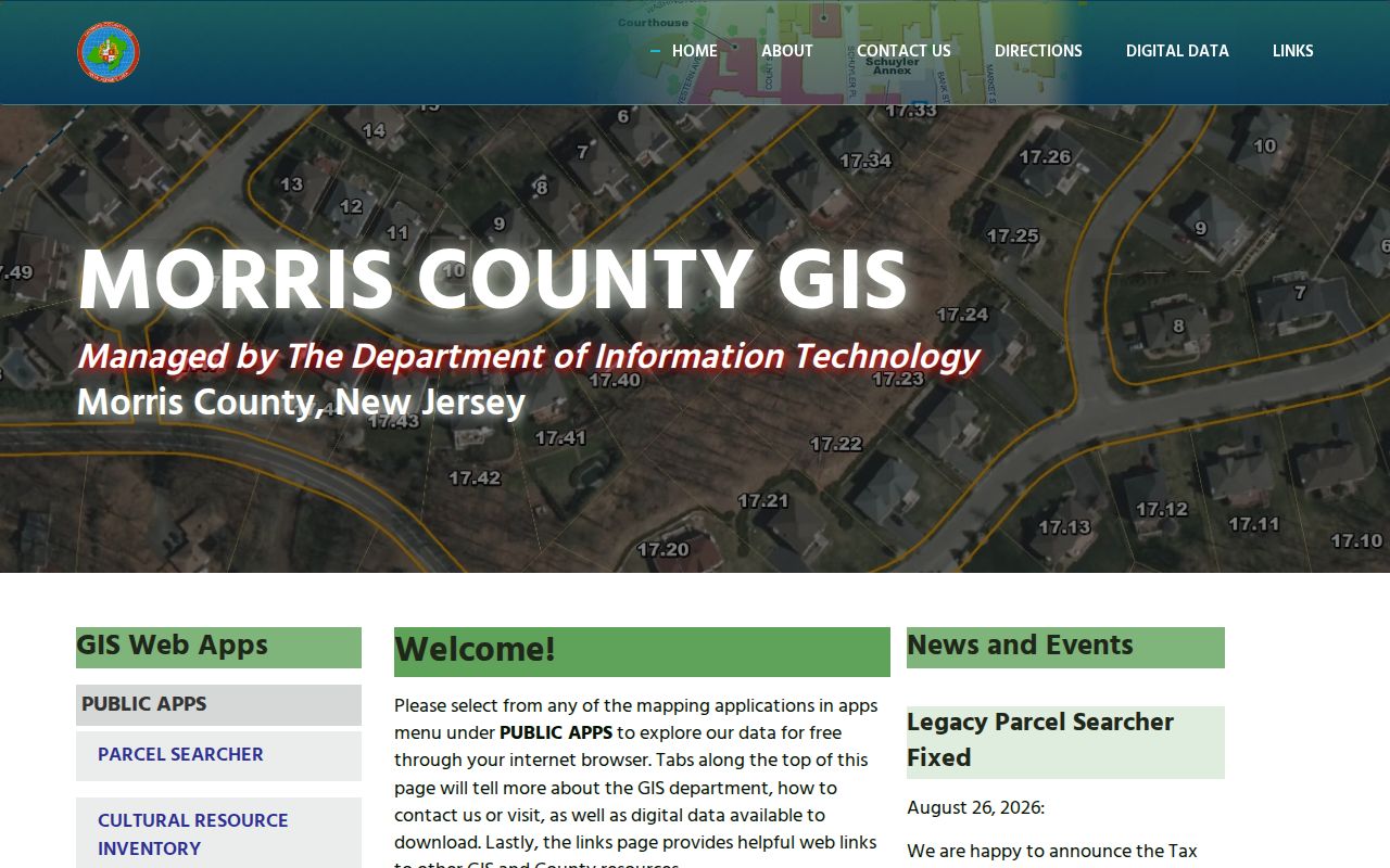
Use the map to find the road and parcel, then move to the County Tax Board record for tax district, block, lot, qualifier, and property details. GIS expressly cautions that its layers are dynamic and may contain positional or data errors. The map parcel is a bridge to the official record, not a final ownership finding.
Montville Address Record Labels
When a postal result and a local record appear inconsistent, capture the labels rather than forcing them into one field. A small research log prevents a mailing address from being mistaken for a home address or a postal city from being mistaken for the municipality. This is especially important after a road change, subdivision, or historic village reference.
| Field | What It Identifies | Best Source |
|---|---|---|
| Address as entered | The form supplied by the researcher or source | Original document or correspondence |
| USPS-normalized address and ZIP | Delivery formatting and routing | USPS lookup |
| Postal city | USPS place label | USPS lookup |
| Municipal district and block/lot | Tax and parcel identity | County Tax Board and GIS |
| Map date | When the geographic layer was checked | Morris GIS map record |
Deeds and subdivision maps supply the legal description when a tax or mailing label is not enough. A county map can clarify the township boundary, while the municipal office remains the proper authority for an official civic-address decision.
Use the same comparison when an older document carries a rural-route, village, or neighboring postal label. Start with the label as written, preserve its date, and then match the road, cross street, owner, and block and lot where available. A correct postal result can improve mailing accuracy without resolving an older parcel description by itself.
Montville Postal Research Notes
Postal routing is a useful first check for a reunion, family-history, correspondence, or property-record question. It is not evidence of household membership. Utility account names and delivery addresses are not general public records, and a school, flood, election, or postal boundary should not be converted into an assumption about who lives at an address.
Use the record keeper that owns the fact: USPS for delivery form, the county for parcel mapping and tax identity, the Clerk for recorded documents, and Township offices for local address, zoning, or permit records. New Jersey’s Open Public Records Act, N.J.S.A. 47:1A-1 et seq., supports focused records requests, but a request should identify the address, block and lot, record type, and date range rather than ask for an unsupported postal roster.
For a historical address, preserve the road or cross street, village name, directory year, owner name, and parcel identifier as separate fields. That approach allows an old White Hall or Glenview reference to be compared with a current Towaco delivery result without pretending that the two labels have the same purpose. If the civic address itself is disputed, the Township office is the authority to ask, not the postal search result.
Note: Date every postal and map check because routing and map layers can change.